


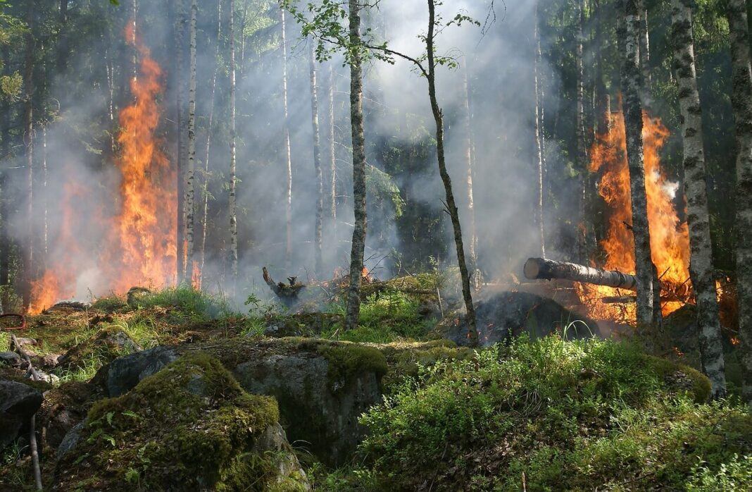
Ever heard of the phrase, ‘Where there’s smoke, there’s fire’? For decades fire tower lookouts and satellites have been used to detect forest fires once smoke occurs.
New research from Northeastern University aims to predict forest fires before smoke occurs. The study is led by Michal Aibin, a visiting associate teaching professor at the Khoury College of Computer Sciences at Northeastern University’s Vancouver campus.
“Currently, when we think about forest fires, and all the research that is happening around the world … the majority of the work—like 90% of the work—focuses on the detection of the fire,” Albin said.
“But obviously, when we’re detecting the fire, it means it is already there … we want to predict the fires in the area.”
A computer algorithm that predicts fire risk
Aibin has created an algorithm that evaluates and categorizes forests based on their potential fire risk. This allows foresters to identify the most susceptible to fires and take preventive measures before the fire season.
“Our goal is to provide as much information as possible, so they can implement prevention strategies—maintain the forest, do clean-up of debris, maybe a controlled cutting … and in the event of a fire, this fire won’t spread that far or won’t be as devastating as if that fuel was there,” Aibin says.
Global firsts cost $50 billion a year in a normal year
Last year, 1800 forest fires burnt through 135,000 hectares in Canada, costing CAD 650 million.
And forest fire is an immediate danger for many Canadians, with the Government predicting a ‘higher than normal’ fire risk in the last few hours.
“Our modelling shows this may be an especially severe wildfire season throughout this summer,” Prime Minister Justin Trudeau told a news on Monday, June 5, 2023 (Canadian time).
“This is a scary time for many people, not just in Alberta, but right across the country, including in the Atlantic, the North and Quebec, too.”
Government data shared with reporters shows 413 fires spanning multiple provinces and the North were burning on Sunday afternoon, leaving about 26,206 people under evacuation orders in British Columbia, Alberta, Northwest Territories, Saskatchewan, Quebec, and Nova Scotia.
Worldwide, fires cost about USD 50 billion a year, according to the World Economic Forum.
During the 2019/20 Australian Bushfires, economists estimate that fire may have cost up to AUD 100 billion, with 80% of the population affected either directly or indirectly by the fires.
Burnt forest area and cost are likely to increase due to climate changes
It’s probable that hectares and the cost of fire will rise with the changing climate, as well as the increasing severity of drought cycles and the resulting release of carbon.
According to the WEF, the forest fires in 2021 alone released around 645 million tons of carbon dioxide into the atmosphere.
“It’s become more challenging every year,” Aibin says. “Because of (fires) we release more carbon in the air and then the climate gets warmer, so it’s a kind of loop that we need to break.”
The impact of forest fires is not limited to forests and grasslands alone. According to Aibin, the smoke emitted from these fires can travel vast distances, worsening air quality. Furthermore, this can cause respiratory conditions like asthma to become even more severe.
But Aibin’s work occurs before the smoke starts to rise.
Using drones to scan forest areas, Aibin collects data such as the number of flammable debris in the area, the species of trees and their respective flammability, the proximity of water sources, areas with diseases that weaken the trees, and more.
The information is put into a mapping program which then displays the forest and assigns different color-coded classifications based on its flammability risk—from low to extreme.
That information is then made available to foresters who can see the most fire-prone areas, learn why that area is particularly risky, and direct mitigation and prevention strategies.
So far, Aibin has focused on forests near the Thompson River in British Columbia, working with Natural Resources Canada and Transport Canada (government departments responsible for natural resources, including forests, and transportation in Canada, respectively) to collect and analyse data.
Global implications: expand to make more geographically specific
But he sees a worldwide application for the program and is working on expanding the amount and type of risk factors it analyses to make it more geographically specific.
“Expand, expand—get more data, more tree species, more risk factors involved, and get a system that can be applied in British Columbia, all of Canada, the States, and finally globally,” Aibin says.
He also hopes his computer science students can be inspired to apply their skills beyond traditional programming.
“We can make a difference; we can make an impact,” Aibin continues.
“Not only learn these computing skills to be a programmer or tester or designer, we teach those skills, but also with that role comes the responsibility to make an impact in the world.”