


NASA is using satellite data to develop forest predictive modelling, with the information helping global governments make decisions around harvesting, climate change mitigation, and future timber revenues.
The space agency has partnered with Penn State and the Pennsylvania Department of Conservation and Natural Resources (DCNR) in a new partnership to help foresters make informed decisions on seeing, planting, habitat and wildlife management.
The project will be led by Assistant Professor Tony Qiu from the Penn State Department of Ecosystem Science and Management, with the area monitored amongst the most productive forests in the US.
The new project will be multifaceted, protecting forest ecosystems from threats like wildfire, pests and disease, sustainably managing timber to meet industry demands, supporting recreational activity and reducing disturbance risks.
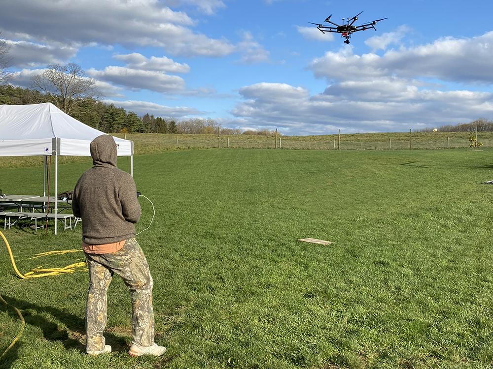
It will support earth-monitoring satellite data with ground-based airborne drone technology to enhance the data collection methods.

“This information will provide a cost-effective way for DCNR foresters to plant seedlings or saplings of selective species in areas where natural regeneration is limited,” Assistant Professor Qui said.
“The remotely sensed habitat also will help DCNR identify areas that would benefit from tree plantings, such as degraded riparian buffers or large forested areas impacted by pest mortality.”
Pennsylvania’s forest lands contain more hardwood growing stock than any other state, supporting a vast forest-products industry and employing nearly 100,000 people.
As Associate Professor Qiu points out, models informed by satellite data products will support critical sustainable timber control by helping managers plan the timing and intensity of timber harvesting, ensuring that it does not negatively impact regeneration capacities.
“Furthermore, our predictive models can generate insights into future timber revenues given different climate warming and management scenarios,” he said.
“To assess the tool’s effectiveness, DCNR will track the frequency of the technology’s usage in timber sale proposals.”
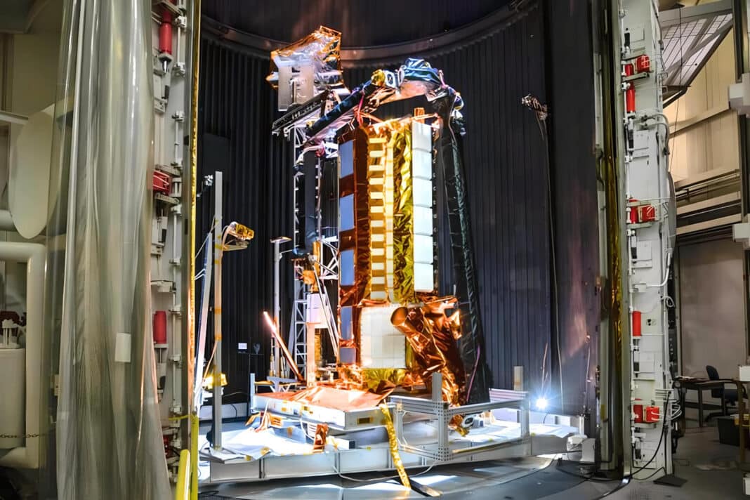
Last month, Wood Central reported that NASA will partner with the Indian Space Research Organisation (ISRO) to monitor global deforestation in near real-time for the first time.
Set for launch in January 2024, the NASA-ISRO Synthetic Aperture Radar (NISAR) will scan the Earth’s land and ice surfaces twice every 12 days.
The project has the backing of US President Joe Biden and Indian Prime Minister Narendra Modi, who recently signed the Artemis Accords and is part of the commitment of both countries to boost cooperation and explore opportunities in space exploration.
“It will allow us to get a sweeping perspective of the planet in space and time,” according to Paul Rosen, the project scientist at NASA’s Jet Propulsion Laboratory in Southern California.
“It can give us a reliable view of exactly how Earth’s land and ice are changing.”